MINNEAPOLIS – More than 4.2 million acres of cropland in four major Corn Belt states sit in flood-prone areas that generate emissions, adding to climate change and threatening drinking water quality, a new Environmental Working Group analysis finds.
The acres in Illinois, Iowa, Minnesota and Wisconsin are in the 100-year flood plain – areas with a 1% chance of flooding in any given year. Iowa has over 1.7 million of those acres, with more than 981,000 planted with corn. Wisconsin has the smallest total acreage in the flood plain but the highest share of the four states dedicated to corn, at 59%.
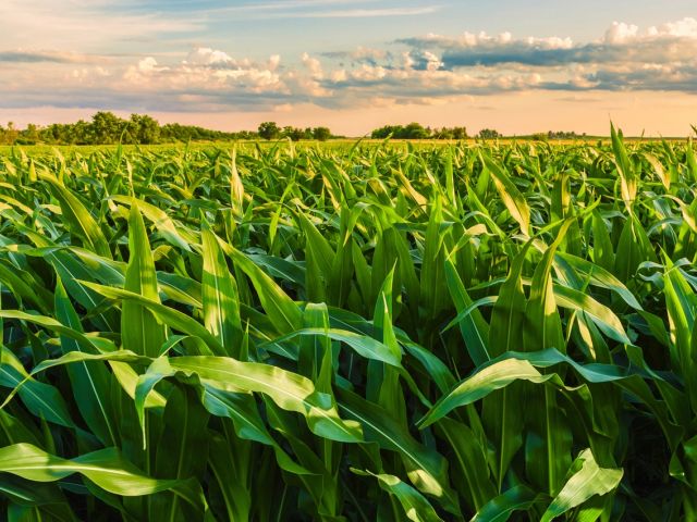
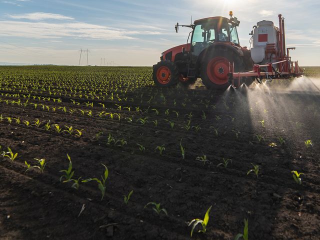
Corn is an especially problematic crop in these areas, because of heavy application of nitrogen fertilizer. When fields flood, they can generate nitrous oxide emissions that contribute to climate change and contaminate drinking water with nitrate.
This double pollution of the air and water highlights a largely overlooked aspect of the harm agriculture can cause to the environment.
Two pollution problems
Tackling agriculture’s contribution to climate change is vital, as the sector’s greenhouse gas emissions rise and emissions from other sectors drop. Flood-prone cropland emits nitrous oxide that warms the Earth nearly 300 times more than carbon dioxide. Nitrous oxide already accounts for 52% of total U.S. agricultural greenhouse gas emissions and roughly 6% of all U.S. emissions.
Addressing cropland flooding will also help in reducing the amount of nitrate running off into drinking water. High nitrate levels in drinking water can cause blue baby syndrome, a potentially fatal condition that deprives infants of oxygen. Even lower levels of nitrate in tap water have been linked to increased risk of birth defects and cancer.
“Flooded cornfields lead to a polluted environment,” said EWG Senior Geographic Information System Analyst Al Rabine, author of the analysis. “Tools exist to fix this. We’re just not using them nearly enough.”
The federal government spends billions of dollars annually on farm conservation programs, but EWG’s analysis finds funding is not being directed where it could have the most benefit.
Stronger federal and state conservation programs could help farmers adopt practices that reduce climate and water pollution, along with permanently retiring cropland in flood plains where farming poses the greatest risks.
Case study in Minnesota
To examine the problem at the local level, EWG modeled cropland within the 2-year flood plain of the Middle Fork Zumbro River watershed, in Southeast Minnesota. The 2-year flood plain is an area expected to flood, on average, once every two years – it has a 50% chance of flooding in any particular year.
The region has long struggled with nitrate contamination in drinking water, in part because it sits atop karst soils through which water and contaminants can easily leach into groundwater. The Middle Fork watershed covers 566 square miles and contains over 100,000 acres of total cropland, more than half of it corn.
EWG’s analysis found between 1,619 and 6,435 acres of cropland within the likely 2-year flood plain. Most of the cropland is corn, ranging from 1,083 to 4,058 acres, depending on inundation level – the amount of flooding.
This means potentially more than 4,000 acres of heavily fertilized corn fields could flood every other year in this single watershed alone, repeatedly spiking both nitrous oxide emissions and nitrate runoff into local water supplies.
Improving conservation programs
The federal government spends billions of dollars annually on farm conservation programs. But EWG’s analysis finds that funding is not being effectively directed to the practices and places where it would have the most benefit.
The Environmental Quality Incentives Program, or EQIP, is one of the primary federal working lands conservation programs. But EWG’s Conservation Database shows that six of the 10 most highly paid EQIP practices between 2017 and 2024 were structural: fencing, sprinkler systems, manure pit covers, animal waste storage and irrigation pipelines. Farmers received $2.59 billion for these practices, accounting for 25% of all EQIP spending.
Many of these practices provide no climate benefit, and some recipients are factory farms legally required to implement them anyway.
The practices most effective at reducing nitrous oxide emissions and nitrate runoff in flood-prone areas – cover crops, crop diversification, reduced tillage and buffer strips – receive far less support than they should.
“Federal conservation dollars are not being spent where they’ll make the biggest difference,” said Rabine. “Paying livestock operations to install fencing while flooded corn fields keep double polluting is not a conservation strategy; it’s a missed opportunity.”
Opportunities for reform
EQIP should be updated to allow states to pay 90% of the cost for practices, such as cover crops and crop diversification, that demonstrably reduce greenhouse gas emissions. Bipartisan legislation already exists to move in this direction.
EWG also recommends that the USDA and Midwest state agencies make a priority of funding conservation practices on cropland within flood plains in particular, because that’s where problems are most acute and the benefits of intervention are greatest.
Federal and state agencies should also better map and designate flood-prone agricultural land, so conservation resources can be more precisely targeted.
###
The Environmental Working Group (EWG) empowers people to live healthier lives in a healthier environment. Through research, advocacy and unique education tools, EWG drives consumer choice and civic action.